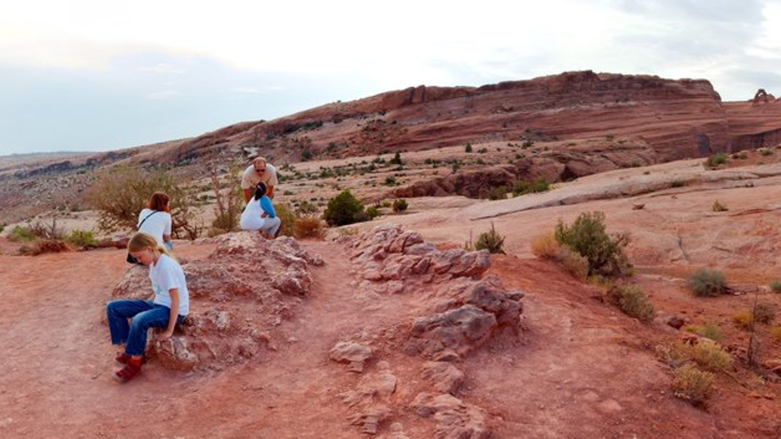
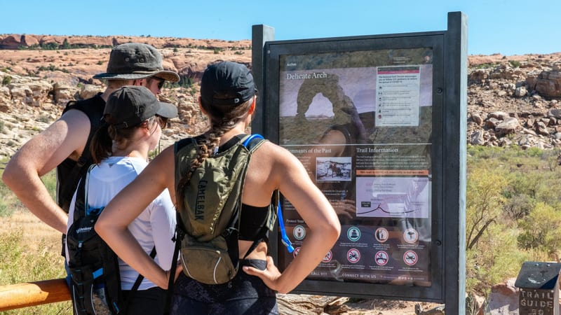
PARKS Atlas
A 360-degree panoramic view across red sandstone slabrock terrain with sparse desert scrub, distant layered mesa formations, and a partly cloudy sky at dusk.

Utah · National Park · Trails

Hiking in Arches

Full sun, slickrock, and no water — the arches that ask for a trail ask for the whole thing.

Map

Explore Arches

Explore more

Trails

The trails worth your time in Arches

Arches is a walking park before it's a hiking park — most of the headline arches sit a short stroll from a pullout. But the ones that ask for a trail ask for the whole thing: full sun, slickrock, and no water. Delicate Arch is the signature climb; Devils Garden is the long day past eight arches; the Fiery Furnace is a permit-or-ranger-only maze. Shade is almost nonexistent and summer ground temperatures are dangerous, so carry water and hike early — these trails are sorted by how hard they are and how much sun they cost.

Delicate Arch in Arches National Park frames the night sky, with a lone silhouetted hiker standing beneath the freestanding sandstone arch.

Delicate Arch

4.9 (37,178)

3.0 mi 480 ft gain 2–3 hr

Hard Out & back

The slickrock climb to the park's signature free-standing arch. Fully exposed end to end, so go at dawn or for the last light at sunset and carry more water than you think you need. Trail distances are planning estimates — verify against NPS.gov.

Three hikers study a Devils Garden trail information sign at Arches National Park, surrounded by red sandstone formations under a blue sky.

Devils Garden

4.9 (15,818)

1.9–7.8 mi 1,150 ft gain 1 hr – half day

Moderate Loop or out & back Kid friendly

An easy, flat walk to Landscape Arch — or the full primitive loop past eight arches with scrambling and route-finding over the fins. Pick your distance: turn around at Landscape Arch, or commit to the loop. Distances are planning estimates — verify against NPS.gov.

A desert landscape in Arches National Park featuring orange-red sandstone fins in the foreground, with snow-capped La Sal Mountains behind.

Fiery Furnace

4.9 (6,529)

~2 mi Variable gain

Hard Route-finding Permit required

A maze of sandstone fins with no marked trail. You cannot enter without a ranger-led ticket or a self-guided exploration permit, both issued through Recreation.gov — and the ranger tickets sell out fast. For confident, agile hikers comfortable with route-finding and scrambling.

A massive red sandstone arch frames a vivid blue sky at Arches National Park, with stone staircase steps leading up through desert scrub toward a lone hiker …

The Windows Loop

1.1 mi 134 ft gain 0.5 hr

Easy Loop Kid friendly

A short loop in the Windows Section that links North Window, South Window, and free-standing Turret Arch, with views across the Cove of Caves and the Parade of Elephants. The Windows Section sits about 12 miles in from the entrance and parking fills early, so arrive before 9 am or after 1 pm; there is no drinking water at the trailhead, so carry your own. There is little shade once the day heats up, and Arches dropped its peak-season timed-entry reservation for 2026 — no advance entry ticket is needed.

Double Arch, a massive pair of natural sandstone arches sharing a common wall, rises against a clear deep-blue sky in Arches National Park; warm midday sunli…

Double Arch Trail

0.6 mi 91 ft gain 0.3 hr

Easy Out & back Kid friendly

A short, mostly flat out-and-back over sandy ground to the base of Double Arch in the Windows Section, with an optional scramble at the end. The first stretch is gravel and dirt and the trailhead view alone is worth the stop if you want to skip the full walk. The Windows lot fills early, so come before 9 am or after 1 pm; carry water and sun protection, and note Arches dropped its peak-season timed-entry reservation for 2026 — no advance entry ticket is needed.

Towering sandstone fins and monoliths line a narrow corridor at Arches National Park, bathed in warm golden-orange sunrise light that illuminates the upper r…

Park Avenue Trail

1.8 mi 308 ft gain 0.8 hr

Easy Out & back Kid friendly

One of the first scenic stops past the visitor center, this walk descends into a canyon lined with towering red rock fins and pinnacles down to Courthouse Towers. Many hikers do it point to point with a car shuttle between the two trailheads; for a round trip, retrace your steps rather than walk the road. There is almost no shade and steep sections near the start, so bring water and start early, and note Arches dropped its peak-season timed-entry reservation for 2026 — no advance entry ticket is needed.

A large natural sandstone arch frames a sweeping desert canyon view beyond, with warm orange-red rock layers stacked above and vivid blue sky with wispy clou…

Tower Arch Trail

2.6 mi 616 ft gain

Moderate Out & back

A secluded hike to a large arch hidden behind the Klondike Bluffs on the park's remote western side, passing the row of sandstone towers known as the Marching Men. The constant up-and-down adds more effort than the elevation suggests, and traffic is light, so carry plenty of water. Access is via Salt Valley Road, a long unpaved road off the main park road that is impassable when wet and far from the main attractions; downloading a map ahead is wise. Arches dropped its peak-season timed-entry reservation for 2026 — no advance entry ticket is needed.

Trail data powered by AllTrails. Save offline maps, see live conditions, and download GPX tracks with AllTrails+.

Arches trail conditions alerts

One email when smoke, storm, or fire affects Arches trail access. Trail-specific — not the same as our lodging alerts.

Save on Entry

One pass covers Arches — and every other US national park.

The America the Beautiful annual pass pays for itself in two or three park visits. Free entry, free passenger fees, and no more fumbling for a credit card at the kiosk.

America the Beautiful National Park Pass — the 2026 annual pass card Buy your pass → Learn more about the pass

Ships from US Park Pass. Free shipping in the continental US.