Can you do this?
The White Rim Road — what it takes
The White Rim circles below the Island in the Sky mesa on the white sandstone bench, above the inner gorge of the Colorado and Green rivers. It suits self-sufficient 4WD drivers or strong mountain bikers with a support vehicle who can handle remote desert with no services, no water, and steep shelf-road descents like the Shafer switchbacks. It is not for stock SUVs or unsupported riders.
- Distance 100 mi
- Time 2–4 days
- Permit Day-use or overnight permit
- Season Spring & fall; summer dangerous
A permit is required — a day-use permit to drive or ride it in a day, an overnight permit for the campsites — and both are competitive in spring and fall through recreation.gov. Beyond the permit: high-clearance 4WD only, all your own water, and the Shafer Trail descent is no place to learn shelf-road driving. Rain turns the clay greasy and washes out the climbs.
The route, in order
How the route runs
Each stop below is a real place on the park's map — walked in sequence, with how long you spend at each.
-
The drop-in
From the mesa top the Shafer Trail switchbacks plunge 1,400 feet to the bench — the loop's committing descent. Look at it from the overlook before you commit to driving it.
-
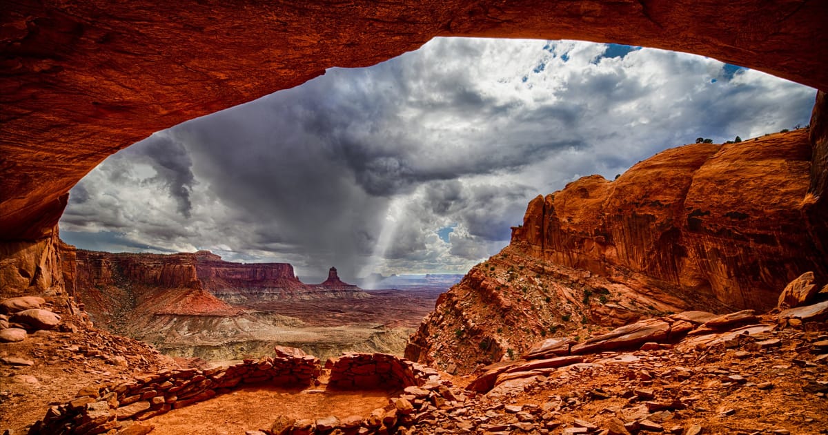
On the bench
Out on the White Rim itself, the bench road runs the edge above the inner gorge of the Colorado. This is the heart of the loop — slow miles, big exposure, no services.
-
The far side
The west side follows above the Green River; the mesa-rim overlook shows the country you've been circling. From here the road climbs back out via Mineral Bottom.
Before you can go
Permit & logistics
A day-use permit (drive or ride in a day) or an overnight permit (designated campsites) is required, via recreation.gov. [VERIFY: current reservation windows, overnight site quotas, day-use limits, and fees against NPS Canyonlands before publishing.]
Plan B
If conditions turn
A multi-day route has more ways to go wrong than a dayhike. Here is what forecloses it — and your move when it does.
- Summer heat
No water, no shade, no services on 100 miles of desert; a summer breakdown becomes an emergency.
Instead: Run it in spring or fall; if you must go in heat, carry far more water than the math suggests and tell someone your route and timing.
- Storm / flash flood
Rain turns the clay sections greasy and can wash out the shelf roads; Mineral Bottom and the Shafer switchbacks are impassable when wet.
Instead: Watch the forecast and don't start the loop with storms building — wait it out on top.
Make it happen
Reserve your spot
The route is decided. The only thing between you and the trail is the permit — settle it now, while it's fresh.
Save on Entry
One pass covers Canyonlands — and every other US national park.
The America the Beautiful annual pass pays for itself in two or three park visits. Free entry, free passenger fees, and no more fumbling for a credit card at the kiosk.
 Buy your pass →
Learn more about the pass
Buy your pass →
Learn more about the pass
Ships from US Park Pass. Free shipping in the continental US.