PARKS Atlas
A mossy, old-growth temperate rainforest trail with rustic wooden log railings winds through massive moss-covered trees toward a slender waterfall visible in…

Washington · National Park · Trails

Hiking in Olympic

Rain forest loops, subalpine ridge walks, and coastal tide-pool routes — each zone is its own hike.

Map

Explore Olympic

Explore more

Trails

Trails across Olympic's three zones

Olympic rewards hikers who commit to a zone rather than rushing between all three in one day. The Hoh Rain Forest loop trails run through old-growth temperate forest under a canopy of moss-draped maple and Sitka spruce — the Hall of Mosses is a 0.8-mile walk, the Hoh River Trail extends for miles into the backcountry. Hurricane Ridge, an hour's drive north and 5,000 feet up, trades the green for subalpine meadows and glacier views — Hurricane Hill and the Cirque Rim trail are the two strongest day hikes here. The coast has its own character: Rialto Beach's Hole-in-the-Wall arch and Second Beach are tide-pool explorations that depend on the tide chart more than your fitness level. Plan each zone as its own half-day or full-day block.

A sea stack rises steeply from a low-tide rocky beach in Olympic National Park, topped with evergreen trees against a clear blue sky.

Cirque Rim Nature Trail

0.8 mi 49 ft gain 17 min

Easy Loop Kid friendly

A short paved loop at Hurricane Ridge offering panoramic alpine meadow views with almost no elevation gain — the most accessible high-country experience in the park, reachable by anyone who can make the 17-mile drive from Port Angeles.

Two hikers sit on a rocky ridge above a sea of clouds, gazing toward a snow-capped mountain range emerging above the cloud layer at twilight.

Cirque Rim to Sunrise View Point Trail

1.3 mi 219 ft gain 36 min

Easy Out & back Kid friendly

An easy out-and-back from the Hurricane Ridge Visitor Center that adds a bit of elevation to the rim loop, ending at a dedicated sunrise viewpoint with open views east over the Olympic range.

A snow-covered mountain slope at a ski resort or winter recreation area features heavily laden evergreen trees in the foreground and a groomed or tracked run…

Elk Mountain Trail Loop

4.6 mi 1,384 ft gain 2.8 hr

Moderate Loop

A moderately challenging loop in the Hurricane Ridge zone that climbs through subalpine meadows to an open ridge with views of Puget Sound on clear days — one of the best elk-spotting routes in the park.

A herd of elk crosses a shallow braided river channel in a forested Pacific Northwest landscape, with bare and evergreen trees lining the far bank.

Grand Lake

7.7 mi 2,395 ft gain 4.7 hr

Hard Out & back

A hard out-and-back through old-growth forest and subalpine terrain to the calm, glacier-carved Grand Lake basin — worth the climb for the quiet alpine setting and wildlife along the approach.

A dirt trail forks in a green subalpine meadow with a turquoise lake to the left, dense evergreen forest ahead, and snow-patched mountain peaks rising under …

Grand Lake via Badger Valley Trail

8.9 mi 2,867 ft gain 5.6 hr

Hard Out & back

The highest-rated trail in the Olympic data set — this out-and-back to Grand Lake routes through the lush Badger Valley, adding creek crossings and wildflower meadows to what is already one of the park's most scenic alpine lake approaches.

A sea stack rises steeply from a low-tide rocky beach in Olympic National Park, topped with evergreen trees against a clear blue sky.

Grand Pass Trail

15.1 mi 5,869 ft gain 10.6 hr

Strenuous Out & back

A strenuous 15-mile out-and-back with nearly 6,000 feet of gain to Grand Pass — the full commitment version of the Grand Valley trail system, suited to peak-baggers and strong hikers who want to earn the highest viewpoints in the area.

Two hikers sit on a rocky ridge above a sea of clouds, gazing toward a snow-capped mountain range emerging above the cloud layer at twilight.

Grand Valley Trail to Viewpoint

1.6 mi 318 ft gain 48 min

Easy Out & back

A quick out-and-back to a valley viewpoint in the Grand Valley trailhead area — a low-effort introduction to the Olympic mountain zone that rewards the approach drive with open meadow views without requiring a multi-hour commitment.

A snow-covered mountain slope at a ski resort or winter recreation area features heavily laden evergreen trees in the foreground and a groomed or tracked run…

Heart O' the Forest Trail

4.7 mi 869 ft gain 2.2 hr

Moderate Out & back

A moderate forest hike through dense old-growth Olympic rainforest with a river crossing — the closest you can get to rainforest character from the north entrance without driving to the Hoh, and a good complement to Hurricane Ridge if you're spending two days.

A paved accessible path winds along a mountainside at Hurricane Ridge in Olympic National Park, with dense evergreen forests, golden meadow slopes, and snow-…

Hurricane Hill via Hurricane Ridge

3.5 mi 803 ft gain 1.8 hr

Moderate Out & back Kid friendly

The most popular hike from Hurricane Ridge Visitor Center — a 3.5-mile out-and-back along an exposed ridge that trades forest for wildflower meadows and delivers the Olympic range panorama most visitors come to Hurricane Ridge to see.

Pink heather and wildflowers carpet a subalpine meadow with snow patches, large boulders, and a lone evergreen tree in the foreground, while jagged rocky pea…

Klahhane Ridge via Switchback Trail

3.1 mi 1,469 ft gain 2.4 hr

Hard Out & back

A short but steep 3-mile climb via the Switchback Trail to the Klahhane Ridge — packs 1,469 feet of gain into a compact out-and-back that rewards with one of the highest accessible viewpoints in the Hurricane Ridge zone.

A calm alpine lake reflects snow-dusted rocky cliffs and evergreen forest under overcast winter light.

Lake Angeles Trail

7.2 mi 2,483 ft gain 4.7 hr

Hard Out & back

A 7-mile out-and-back that climbs steeply from the Hurricane Ridge Road trailhead through dense old-growth to Lake Angeles, a cold alpine lake ringed by rocky cliffs — one of the most dramatic lake destinations reachable from the north entrance.

A herd of elk crosses a shallow braided river channel in a forested Pacific Northwest landscape, with bare and evergreen trees lining the far bank.

Lillian Ridge Way Trail

8.3 mi 2,949 ft gain 5.5 hr

Hard Out & back

A demanding ridge hike that gains nearly 3,000 feet through river terrain and wildflower zones to the Lillian Ridge, with lake views below and one of the most expansive eastern Olympic panoramas in the trail system.

A sea stack rises steeply from a low-tide rocky beach in Olympic National Park, topped with evergreen trees against a clear blue sky.

Maiden Peak from Deer Park Campground

7.2 mi 1,899 ft gain 4.1 hr

Moderate Out & back

A 7-mile out-and-back from Deer Park Campground (accessible via a gravel road from Port Angeles) to Maiden Peak, offering commanding views over the Strait of Juan de Fuca and the San Juan Islands — the north-side Olympic viewpoint most people haven't heard of.

Alpine wildflowers in purple, yellow, and pink bloom on a rocky ridgeline above a cloud-filled valley, with a jagged mountain peak and evergreen slopes visib…

Mount Angeles via Hurricane Ridge Trail

5.8 mi 2,178 ft gain

Strenuous Out & back

A strenuous 5.8-mile climb from Hurricane Ridge to the summit of Mount Angeles — exposed upper terrain and steep switchbacks lead to one of the highest summit points accessible as a day hike from the main north-entrance road.

Alpine wildflowers in purple, yellow, and pink bloom on a rocky ridgeline above a cloud-filled valley, with a jagged mountain peak and evergreen slopes visib…

Mount Angeles via Switchback Trail

3.9 mi 1,978 ft gain

Strenuous Out & back

A strenuous 4-mile route that grinds 2,000 feet of gain up the Switchback Trail to Mount Angeles — a more direct and demanding approach than the Hurricane Ridge trail, suited to hikers who want elevation fast.

A dense Pacific Northwest old-growth conifer forest with tall Douglas-fir or western red cedar trunks rising from a lush green understory of young firs and f…

Obstruction Point - Deer Park Trail

14.4 mi 3,326 ft gain 7.6 hr

Hard Out & back

A demanding 14-mile ridge traverse from Obstruction Point to the Deer Park area, crossing open subalpine terrain with sustained mountain views — ideal for strong hikers who can arrange a car shuttle at both ends.

A herd of elk crosses a shallow braided river channel in a forested Pacific Northwest landscape, with bare and evergreen trees lining the far bank.

Sunrise Ridge Trail to Klahhane Ridge

7.1 mi 2,047 ft gain 4.2 hr

Hard Out & back

A long ridge approach via the Sunrise Ridge Trail, gaining 2,000 feet over 7 miles to Klahhane Ridge — the gradual alternative to the Switchback Trail with more wildflower terrain and a more progressive views experience.

A sea stack rises steeply from a low-tide rocky beach in Olympic National Park, topped with evergreen trees against a clear blue sky.

Sunrise View Point via High Ridge Nature Trail

0.9 mi 219 ft gain 29 min

Moderate Loop

A sub-mile loop from the Hurricane Ridge Visitor Center that climbs slightly above the ridge to a named sunrise viewpoint — the shortest route to open wildflower terrain above the parking area, and worth the 29-minute effort for the views east.

A massive moss-draped tree limb stretches diagonally across the frame in an old-growth temperate rainforest, with long strands of hanging moss and lichens ba…

Hall of Mosses Trail

1.1 mi 82 ft gain 0.4 hr

Easy Loop Kid friendly

A short, mostly flat loop through old-growth temperate rainforest in the Hoh Rain Forest, with moss-draped maples, towering Sitka spruce and Western hemlock, and nurse logs lined with young saplings. The Hoh Valley is one of the wettest places in the continental US, so expect damp, muddy footing and pack waterproof boots. The big logistical catch is access: in summer (June-September), limited parking can mean 1-2 hour waits at the Hoh entrance gate between 10am and 4pm, so arrive early. Dogs are not allowed.

A multi-channel waterfall splits over mossy basalt ledges and drops into a narrow gorge, surrounded by lush temperate rainforest vegetation.

Sol Duc Falls Trail

1.8 mi 262 ft gain 0.8 hr

Easy Out & back Kid friendly

A gentle, short walk through old-growth forest to a three-pronged waterfall where the Sol Duc River drops under a wooden bridge, with a viewing platform at the end. The trailhead sits at the far end of Sol Duc Hot Springs Road, about 14 miles off US-101 south of Port Angeles. Plan around the road: Sol Duc Road closes seasonally in winter, so check NPS current road conditions before you go and treat May through October as the reliable window. Dogs are not allowed.

A low-angle ground-level view of a rocky pebble-strewn beach at sunset, with warm orange and golden light reflecting off wet stones and breaking surf.

Hole in the Wall via Rialto Beach

3.3 mi 85 ft gain 1.0 hr

Easy Out & back Kid friendly

This is a beach walk rather than a trail, heading north about 1.5 miles from Rialto Beach over driftwood logs and rounded cobbles to Split Rock and the Hole-in-the-Wall sea arch, passing tide pools full of starfish along the way. It is tide-dependent: check the tide table and aim for low tide, since a tide above roughly 6 feet can cover the beach and leave nowhere to walk. Parking at Rialto fills fast in summer. Dogs are allowed only the first 0.75 miles to Ellen Creek, not beyond; overnight camping at Hole-in-the-Wall needs a wilderness permit.

A tall, single-drop waterfall cascades down a moss-covered rocky cliff face surrounded by dense temperate rainforest vegetation.

Marymere Falls Trail

1.8 mi 324 ft gain 0.9 hr

Easy Out & back Kid friendly

One of Olympic's most popular short hikes, running from the Storm King Ranger Station on Lake Crescent through old-growth forest to a tall waterfall. It stays mostly flat before a couple of well-maintained switchbacks near the falls, keeping it family-friendly. The trailhead is about 20 miles west of Port Angeles off US-101, and parking is limited, so start early. You can extend onto the Barnes Creek Trail, and Lake Crescent Lodge sits right at the shore nearby. Dogs are not allowed.

A misty Pacific Northwest forest scene with bare-branched deciduous trees adorned with moss and autumn leaves in the foreground, while tall conifers rise beh…

Enchanted Valley Trail

25.6 mi 3,254 ft gain 10.7 hr

Hard Out & back Permit required

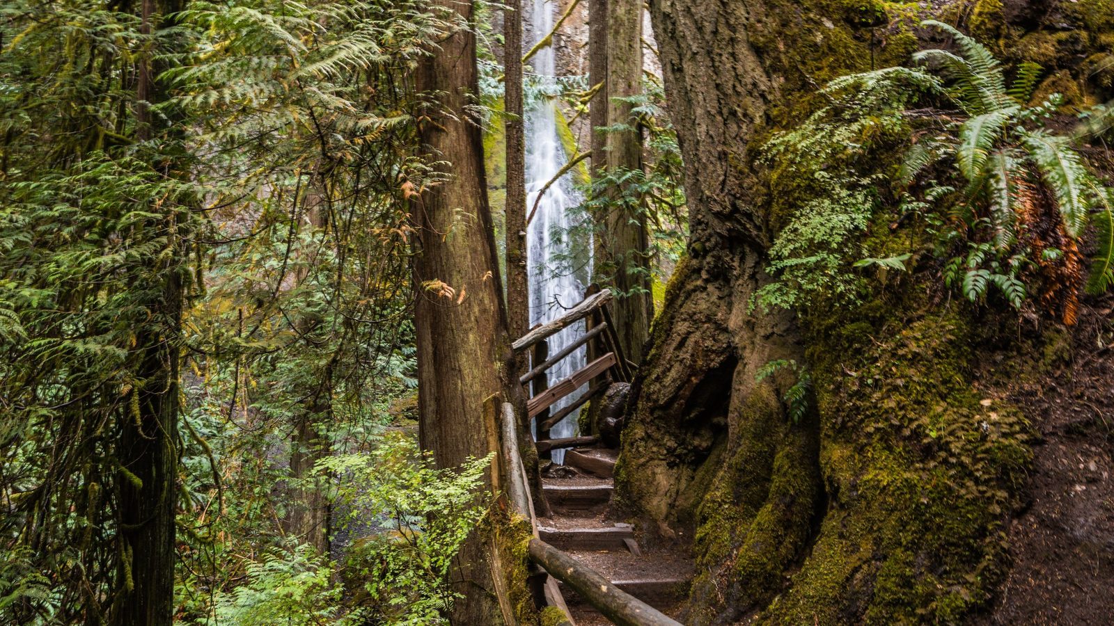
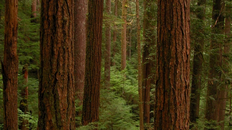
A long backcountry route up the East Fork Quinault River to the historic Enchanted Valley Chalet, starting from the Graves Creek trailhead off South Shore Road. The first stretch to Pony Bridge is forested with few views; past it the valley opens up, and the well-graded trail balances climbing with long flat sections through the river valley. At 25.6 miles round trip with over 3,250 feet of gain, this is a multi-day backpacking trip, not a day hike, with the best window roughly March through September. A wilderness permit is required to camp overnight; check the NPS East Fork Quinault River Trail page for current trail and chalet status before you go. Dogs are not allowed.

A hiker sits on a rocky overlook above a long, narrow fjord-like lake surrounded by forested mountains under an overcast sky.

Mount Storm King

4.4 mi 2,142 ft gain

Strenuous Out & back

A steep climb above Lake Crescent that gains over 2,100 feet in 4.4 miles, starting near the Storm King Ranger Station. The maintained trail ends at about 2 miles, and the final quarter-mile is a steep, rocky scramble up a series of unmaintained ropes that can only be used one person at a time. Most injuries happen on the way down the rope section, so judge your comfort with the descent before committing on the way up; search-and-rescue calls happen here every year. Bring gloves for the ropes, start early before parking fills, and treat April through October as the season. Dogs are not allowed.

Trail data powered by AllTrails. Save offline maps, see live conditions, and download GPX tracks with AllTrails+.

Olympic trail conditions alerts

One email when smoke, storm, or fire affects Olympic trail access. Trail-specific — not the same as our lodging alerts.

Save on Entry

One pass covers Olympic — and every other US national park.

The America the Beautiful annual pass pays for itself in two or three park visits. Free entry, free passenger fees, and no more fumbling for a credit card at the kiosk.

America the Beautiful National Park Pass — the 2026 annual pass card Buy your pass → Learn more about the pass

Ships from US Park Pass. Free shipping in the continental US.