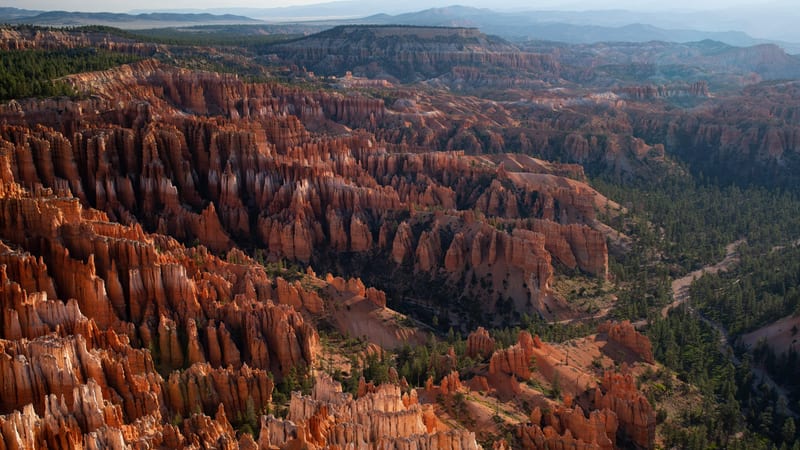
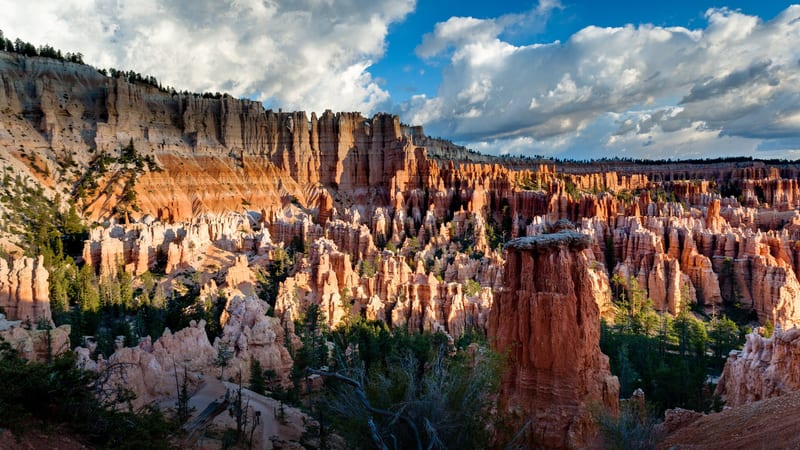
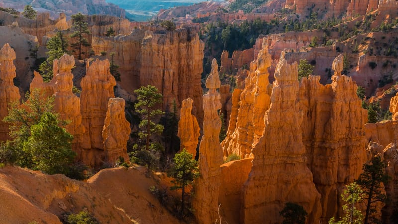
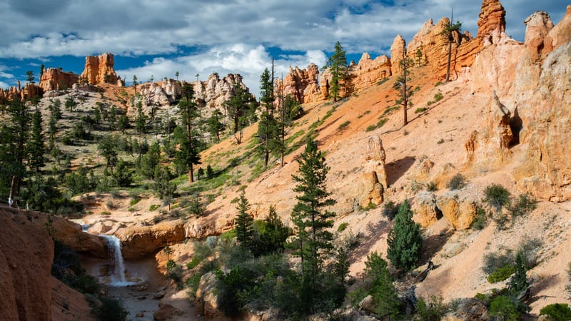
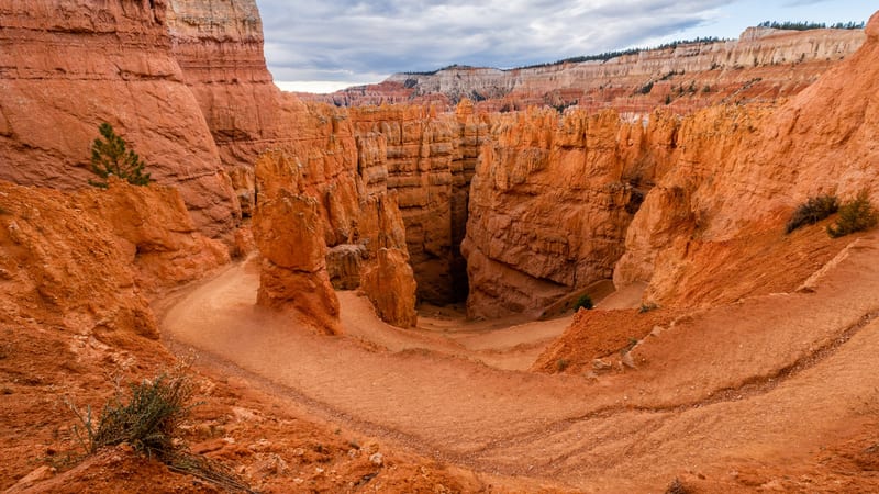
PARKS Atlas
Two hikers descend the Queen's Garden Trail into Bryce Canyon's amphitheater, passing between towering orange and cream-colored hoodoo spires. The narrow dirt path winds through a forest of eroded limestone pillars under a bright midday sky.

Utah · National Park · Trails

Hiking in Bryce Canyon

Every trail drops off the rim into the hoodoos — and the climb back out at 8,000 feet is the work.

Map

Explore Bryce Canyon

Explore more

Trails

The hoodoo trails worth your time in Bryce

Every hike at Bryce starts on the rim and goes down — you drop into the amphitheater among the hoodoos, then climb back out at 8,000 feet, and the return is always the hard part. There is little shade below the rim and afternoon thunderstorms are common in summer, so pace the ascent and carry water. These trails run from a flat, paved rim walk anyone can do to all-day loops that earn their distance; pick by how far below the rim you want to go and how much climb you want at altitude on the way back.

A winding switchback trail descends into a dramatic red sandstone canyon at Bryce Canyon National Park, with towering hoodoos and canyon walls flanking a narrow path.

Navajo Loop

4.9 (7,457)

~1.6 mi +550 ft gain 1–1.5 hr

Moderate Loop

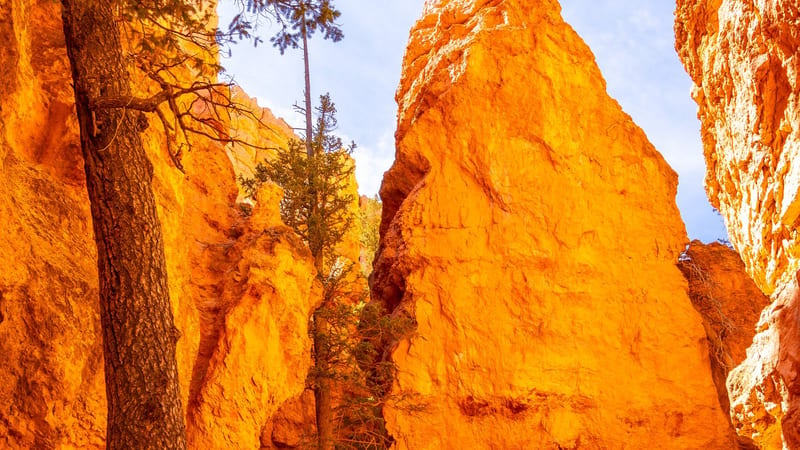
The dramatic descent from Sunset Point through Wall Street's switchbacks, past Thor's Hammer and back up. Short on the map but a steep, sustained climb out at 8,000 feet — the Wall Street side closes seasonally for ice and rockfall, so check status first. The most-walked way below the rim, and the one most people remember.

A sweeping aerial view of Bryce Canyon's iconic hoodoo formations, thousands of tall orange and red sandstone spires densely packed across a vast amphitheater.

Queen's Garden

4.8 (2,662)

~1.8 mi +320 ft gain 1.5–2 hr

Moderate Out & back (or loop) Kid friendly

The gentlest way off the rim into the amphitheater, dropping from Sunrise Point through graded switchbacks among the hoodoos. The walk down is easy; the 320-foot climb back to the rim is the real work. Most hikers link it with the Navajo Loop for the classic Bryce circuit.

A sandy trail winds between tall orange-red hoodoo rock spires and evergreen pine trees in a narrow canyon slot at Bryce Canyon National Park, viewed from gr…

Queen's Garden + Navajo Combination Loop

4.9 (18,000)

~2.9 mi +650 ft gain 1.5–2.5 hr

Moderate Loop

The route most people mean when they say they hiked Bryce — down the gentle Queen's Garden switchbacks from Sunrise Point, across the amphitheater floor among the hoodoos, and back up Wall Street's slot to Sunset Point. Walk it clockwise (down Queen's Garden, up Navajo) to save the steep climb for last on the shorter side. The single best two-to-three-hour hike in the park.

A sweeping amphitheater of densely packed hoodoos in shades of orange, red, and white fills the frame at Bryce Canyon National Park, with warm afternoon ligh…

Peekaboo Loop

4.9 (3,200)

~5.2 mi +1,520 ft gain 3–4 hr

Hard Loop

The deepest of the amphitheater loops, winding through the hoodoos well below the rim with over 1,500 feet of cumulative climbing. It is also the park's horse trail, so expect to share it and the soft, churned tread that comes with it. The reward is the quietest, most immersive time among the spires — but it earns the Hard rating on the climbs at altitude.

A dense field of orange-red sandstone hoodoos rises from the amphitheater floor at Bryce Canyon National Park, with scattered ponderosa pines growing between…

Fairyland Loop

4.9 (2,100)

~8.1 mi +1,555 ft gain 4–5 hr

Hard Loop

The long way around the north end of the amphitheater, starting from Fairyland Point off the main road before the fee booth. Eight miles and 1,500 feet of climbing keep the crowds thin — this is the half-day hike for people who want the hoodoos to themselves. Carry water and watch the afternoon sky; there is no shade and no bail-out halfway around.

Hikers walk along a pale sandstone trail through Bryce Canyon's amphitheater, surrounded by tall orange-red hoodoos, evergreen pines, and layered canyon wall…

Wall Street + Queen's Garden Loop

4.9 (9,000)

~3.3 mi +640 ft gain 1.5–2.5 hr

Moderate Loop

The same celebrated circuit as the combination loop, taken with the Wall Street slot on the descent rather than the climb — a slightly longer variant when Wall Street is open and the ice is gone. Wall Street is the narrow chasm between two-hundred-foot fins with a pair of Douglas firs reaching for the light; it closes in winter and after rockfall, so confirm status before you count on this direction.

Red-orange sandstone hoodoos and canyon walls at Bryce Canyon National Park are silhouetted against a vivid Milky Way core rising over the horizon, with pine…

Rim Trail (Sunrise to Sunset)

4.8 (5,400)

~1.2 mi +85 ft gain 30–45 min

Easy Out & back Dog friendly Kid friendly

The flat, paved stretch of the Rim Trail between Sunrise and Sunset Points — the one walk at Bryce that stays on the rim, takes in the whole amphitheater, and is open to leashed dogs and wheelchairs. The easy answer for anyone who can't or doesn't want to descend into the hoodoos, and the best place to be at sunrise or sunset without committing to a climb.

Two backpackers with trekking poles and large packs hike along a red-dirt trail through Bryce Canyon's interior, surrounded by vivid orange-red hoodoos and e…

Under-the-Rim Trail

22.9 mi 4,366 ft gain 11.6 hr

Hard Point to point Permit required

The Under-the-Rim Trail runs about 22.9 miles point-to-point below Bryce's amphitheater rim, the park's main backcountry route and an overnight backpacking trek that needs a backcountry permit. It tops out above 9,000 feet, so plan for thin air and cold nights, and snow can linger into spring; the trail is best from April through November. Water is scarce and unreliable along the way, so most hikers stash water ahead of time and treat anything they collect. The common plan is to take the Rainbow Point shuttle and hike north, losing over 1,000 feet of elevation toward the main trailhead.

A forested high-plateau overlook reveals a sweeping valley of pine and juniper woodland, with distant mesa formations rising through atmospheric haze under a…

Riggs Spring Loop Trail

8.9 mi 1,850 ft gain 4.5 hr

Hard Loop Permit required

The Riggs Spring Loop is an 8.9-mile loop from the Rainbow Point area at the park's far south end, dropping through spruce, fir, and bristlecone forest with red cliff breaks and aspen groves opening views east and south. It sits above 9,000 feet, so expect thin air and a snow-bound trail into spring; the best window is March through October. It doubles as a backcountry camping area, so overnight trips need a backcountry permit. A spring near the midpoint offers shade, but treat that water before drinking and carry plenty of your own. Parking and restrooms are at Rainbow Point, and the lot fills early on busy days.

A canyon landscape with vivid orange and red hoodoo spires rising above sandy slopes dotted with pine trees, with a small waterfall cascading over an orange …

Mossy Cave Trail

0.9 mi 118 ft gain 0.4 hr

Easy Out & back Kid friendly

Mossy Cave is the easy family option, a 0.9-mile out-and-back off Highway 12 near Tropic, outside the main amphitheater with no shuttle needed and no permit required. The short, low-gain walk follows a creek past hoodoos to a small waterfall and a sheltered overhang filled with moss in summer and icicles in winter. The stream comes from an 1890s pioneer irrigation ditch, so water flows seasonally through Water Canyon. It is a quick way to get the canyon experience without descending into it; parking is small and fills fast, so arrive early.

Trail data powered by AllTrails. Save offline maps, see live conditions, and download GPX tracks with AllTrails+.

Bryce Canyon trail conditions alerts

One email when smoke, storm, or fire affects Bryce Canyon trail access. Trail-specific — not the same as our lodging alerts.

Save on Entry

One pass covers Bryce Canyon — and every other US national park.

The America the Beautiful annual pass pays for itself in two or three park visits. Free entry, free passenger fees, and no more fumbling for a credit card at the kiosk.

America the Beautiful National Park Pass — the 2026 annual pass card Buy your pass → Learn more about the pass

Ships from US Park Pass. Free shipping in the continental US.